

Virtual tours have changed the way people view and share spaces online. For real estate marketing, remote walkthroughs, property documentation, and client presentations, a 3D virtual tour can make a space easier to understand without being there in person.
Platforms such as Matterport are widely used for digital twins, online space viewing, and immersive property experiences. For many teams, this is a valuable workflow when the main goal is to present a space visually, share it remotely, or create a clear digital walkthrough.
But some projects need more than a virtual tour.
Interior designers, architects, renovation contractors, construction teams, and scanning service providers often need outputs that support real design and documentation work: point clouds, editable CAD drawings, BIM references, floor plans, 3D models, and measurable as-built data.
That is where a portable LiDAR scanner can become a better fit. Instead of focusing mainly on online viewing, portable LiDAR scanning helps teams capture real-world spaces as usable project data for CAD, BIM, renovation planning, and 3D modeling.
When a Virtual Tour Is the Right Workflow
A virtual tour is useful when the main goal is to help people view a space remotely. It allows clients, buyers, project teams, or stakeholders to walk through a property online and understand the layout visually.
Virtual tour platforms are especially helpful for:
- Real estate listings
- Property marketing
- Remote walkthroughs
- Client presentations
- Facility visibility
- Basic space documentation
- Online collaboration
For these use cases, a virtual tour can be simple, visual, and easy to share. If your goal is to show a space online, support property marketing, or help clients understand the look and feel of a room, a virtual tour workflow may be enough.
Matterport, for example, is strong in digital twins and immersive 3D walkthroughs. It also offers CAD and BIM-related services for users who need additional deliverables. So the question is not whether virtual tours are useful. The real question is whether your project needs more than a visual walkthrough.
When Teams Need More Than a Virtual Tour
A virtual tour helps people see a space. However, design and construction teams often need to work with the space.
That means they may need accurate, editable, and reusable data for professional workflows. For example, an interior designer may need a floor plan for layout planning. A renovation contractor may need CAD-ready drawings. A BIM team may need point cloud references. A scanning service provider may need to deliver multiple file types to different clients.
In these cases, teams often need:
- Point cloud data
- Editable CAD drawings
- DWG or DXF files
- BIM references
- Revit-friendly workflows
- 2D floor plans
- 3D models
- As-built documentation
- Room scan to 3D model workflows
- More control over project deliverables
If your team frequently needs these outputs, a portable LiDAR scanner can provide a more flexible workflow than relying only on a virtual tour platform.
Virtual Tour vs Portable LiDAR Scanner: Key Workflow Differences
Virtual tour platforms and portable LiDAR scanners can both help digitize real spaces, but they are built around different goals.
| Workflow Need | Virtual Tour Platform | Portable LiDAR Scanner |
|---|---|---|
| Main purpose | Online viewing and digital walkthroughs | Reality capture and measurable project data |
| Best for | Property marketing, remote viewing, visual communication | CAD, BIM, floor plans, 3D models, as-built documentation |
| Output focus | 3D tours, photos, floor plans, digital twins | Point clouds, CAD-ready data, BIM references, 3D models |
| Data control | Often platform-based | More flexible for in-house processing and deliverables |
| Ideal users | Real estate teams, property marketers, facility viewers | Designers, contractors, architects, engineers, scan service providers |
| Long-term workflow | Strong for sharing and viewing spaces | Strong for repeated project documentation and technical outputs |
The best choice depends on the final deliverable. If you mainly need a visual tour, a virtual tour workflow is a strong option. If you need technical files for design, renovation, CAD, or BIM, portable LiDAR scanning may be more practical.
Why CAD, BIM, and Point Clouds Matter
For many professional teams, the real value of 3D scanning is not only the ability to view a space. It is the ability to use the scan data in design and construction workflows.
Point Clouds
A point cloud is a digital record of the scanned space. It can show walls, floors, ceilings, openings, columns, beams, and other site details. Designers and engineers can use point clouds to check dimensions, review existing conditions, and create more reliable design references.
CAD-Ready Drawings
CAD files are important for renovation planning, floor plan editing, construction documentation, and design development. A scan to CAD workflow can help teams move from real-world data to editable drawings such as DWG or DXF files.
BIM References
BIM workflows are useful for architecture, engineering, construction, and facility management. Scan data can provide a reference for existing conditions, helping teams create or update building models with better site information.
3D Models
3D models help designers and clients understand space, volume, layout, and design changes more clearly. For interior design, renovation, and construction communication, 3D models can make project decisions easier to discuss.
How Portable LiDAR Supports CAD and BIM Workflows
A portable LiDAR scanner captures the real space as spatial data. Instead of measuring one distance at a time, users can walk through the space and collect a more complete digital record.
A typical portable LiDAR workflow includes:
- Scan the space: Capture rooms, buildings, job sites, or renovation areas with a handheld LiDAR scanner.
- Process the point cloud: Convert scan data into a measurable point cloud for review, measurement, and documentation.
- Generate floor plans or CAD files: Use scan data to support floor plans, DWG/DXF drawings, or other CAD-ready outputs.
- Use the data for BIM or 3D modeling: Bring scan-based references into design software or BIM workflows for modeling and coordination.
- Share deliverables with clients or project teams: Provide floor plans, CAD files, 3D models, point cloud data, or visual references depending on the project need.
This workflow is useful for teams that want more control over how their scan data is processed, exported, and reused.
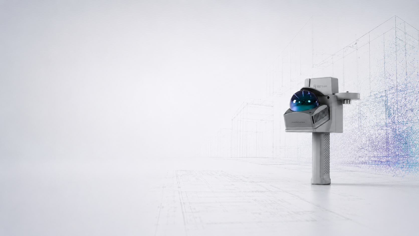
How FJD Trion Supports Professional 3D Scanning Deliverables
FJD Trion provides portable LiDAR scanners and software workflows for users who need more than basic visual presentation. For interior design, renovation, construction, and documentation projects, FJD Trion helps turn real spaces into usable digital data.
FJD Trion Model
FJD Trion Model is designed for 3D point cloud processing and professional scan data workflows. It supports point cloud processing, measurement, 3D modeling, and CAD/BIM-related outputs. For teams that need to work with scan data directly, this provides more flexibility than a view-only workflow.
Scan to CAD
For users who need CAD-ready data, FJD Trion Scan to CAD helps convert LiDAR scan data into editable drawings and documentation. This can support DWG/DXF workflows, floor plans, sections, and project records for renovation, construction, and lifecycle management.
Scan to BIM
For BIM users, FJD Trion also supports scan-to-BIM workflows with a Revit Plug-in. This helps connect FJD Trion Model and Revit, making it easier to move from scan data to BIM-related modeling and review.
Interior Design Outputs
For interior design and renovation teams, FJD Trion workflows can support 2D floor plans, 3D models, CAD references, and visual presentations. This makes it easier to move from site capture to design-ready outputs.
Where Matterport and FJD Trion Fit Differently
Matterport is a strong option when teams need a polished digital twin, a virtual tour, and easy online space sharing. It is especially useful for real estate, property marketing, remote viewing, and visual collaboration.
FJD Trion is positioned differently. It is better suited for professionals who need portable LiDAR scanning and more flexible technical deliverables, including point clouds, CAD-ready drawings, BIM references, floor plans, and 3D models.
A simple way to think about it is:
- Choose a virtual tour workflow if your main goal is to view and share a space online.
- Choose a portable LiDAR workflow if your main goal is to measure, document, model, edit, or deliver technical files.
For some teams, both workflows may be useful. A virtual tour can support presentation and communication, while LiDAR-based scan data can support CAD, BIM, and detailed documentation.
Who Should Consider Portable LiDAR Instead of Only a Virtual Tour?
Portable LiDAR scanning is especially useful for users who need repeated technical deliverables, not just visual walkthroughs.
It may be a better fit for:
- Interior designers who need floor plans and 3D models
- Renovation contractors who need as-built documentation
- Architects who need point cloud references
- Construction teams that need site documentation
- BIM teams that need scan-based modeling references
- Scan service providers who want to offer CAD and BIM deliverables
- Facility teams that need measurable digital records
- Design studios that want more control over scan data and file exports
If your project ends with a client viewing a space online, a virtual tour may be enough. If your project continues into CAD drafting, BIM modeling, renovation planning, or 3D design, portable LiDAR scanning may offer more value.
Final Thoughts: Choose the Workflow Based on the Deliverable
Virtual tours and portable LiDAR scanners are not the same type of workflow. They can overlap, but they solve different problems.
A virtual tour is excellent for viewing, sharing, and presenting a space online. A portable LiDAR scanner is more useful when the team needs measurable data, point clouds, CAD-ready drawings, BIM references, floor plans, and 3D models.
For teams that need more than a virtual tour, FJD Trion portable LiDAR scanners provide a practical way to capture real-world environments and turn them into professional project deliverables.
Explore FJD Trion portable LiDAR scanners for CAD, BIM, floor plans, and 3D model workflows.
FAQ
Is a virtual tour enough for interior design or renovation?
A virtual tour can help with viewing and communication, but interior design and renovation teams often need more detailed outputs such as floor plans, point clouds, CAD drawings, 3D models, and as-built documentation.
What is the difference between a virtual tour and a LiDAR scan?
A virtual tour is mainly used for online viewing and presentation. A LiDAR scan captures spatial data that can be processed into point clouds, measurements, CAD drawings, BIM references, floor plans, and 3D models.
Is FJD Trion a Matterport alternative?
FJD Trion is not a direct replacement for every Matterport use case. Matterport is strong for virtual tours and digital twins. FJD Trion is better suited for users who need portable LiDAR scanning, point cloud control, CAD-ready drawings, BIM references, and 3D model deliverables.
Can portable LiDAR scans be used for CAD?
Yes. Portable LiDAR scans can be processed into point clouds and used in scan to CAD workflows. Depending on the software workflow, users can create CAD-ready outputs such as DWG or DXF drawings.
Can portable LiDAR support BIM workflows?
Yes. Portable LiDAR can support BIM workflows by providing scan-based references of existing site conditions. With the right software, point cloud data can be used for BIM modeling, renovation planning, and as-built documentation.
Matterport is a trademark of its respective owner. FJD Trion is not affiliated with, sponsored by, or endorsed by Matterport. This article is intended for general workflow comparison and educational purposes only.
How 3D Scanning Helps Reduce Rework in Interior Design Projects
Matterport vs LiDAR Scanner: Which Workflow Is Better for CAD and BIM?