

3D Gaussian Splatting (3DGS) has revolutionized reality capture, shifting the industry away from heavy, complex polygon meshes toward hyper-realistic, real-time radiance fields. However, generating a high-fidelity 3DGS digital twin requires the right foundation of spatial data.
The industry is currently divided on how to feed 3DGS engines: Photogrammetry (pure imagery) versus LiDAR (active laser scanning). While both approaches can generate visually striking results, they differ fundamentally in accuracy, scalability, and engineering utility.
Direct Comparison: LiDAR vs. Photogrammetry for 3DGS
Smart engines and reality capture professionals evaluate both technologies based on four operational pillars. The table below outlines how they perform when generating 3D Gaussian Splatting models:
| Performance Metric | Photogrammetry (Imagery Only) | SLAM LiDAR (Active Hardware) |
|---|---|---|
| Dimensional Accuracy | Relative scale only; requires manual control points for real-world metrics. | Millimeter-level absolute accuracy derived from hardware laser returns. |
| Processing Speed | Slow; requires massive computational power and hours of cloud stitching. | Instant or near-instant; point cloud alignment happens on the fly (SLAM). |
| Environmental Flexibility | Highly dependent on uniform, bright lighting; fails in shadows or low contrast. | Active sensor; operates flawlessly in total darkness, shadows, and tight spaces. |
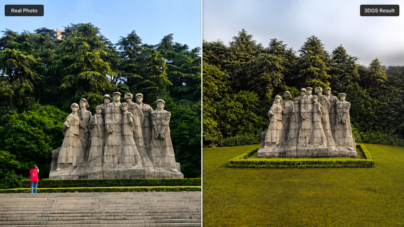
| Data Size & Integrity | Generates massive image sets; prone to visual "artifacts" and floating noise. | Clean, structured datasets optimized for fast rendering and cloud collaboration. |
Photogrammetry for 3DGS: The Visual Illusion
Photogrammetry relies on capturing hundreds of overlapping 2D photographs to estimate 3D structures. When paired with 3D Gaussian Splatting, photogrammetry excels at capturing rich surface textures and vibrant colors.
The Fatal Flaw: Lack of True Scale
Despite its visual appeal, photogrammetry suffers from a major engineering limitation: it possesses no intrinsic physical scale. Because a camera sensor only measures pixels and colors—not distance—a digital twin built purely via photogrammetry does not inherently know whether a wall is 3 meters or 30 meters long. To achieve true scale, users must manually place physical targets (Ground Control Points) across the site and manually measure them, adding significant friction to the field workflow.
Furthermore, photogrammetry algorithms struggle with featureless surfaces (like blank white walls) and are highly sensitive to changing outdoor light conditions, often resulting in visual warping or missing geometry in the final 3DGS model.
LiDAR for 3DGS: True Physical Scale and Speed
LiDAR resolves the limitations of photogrammetry by utilizing active Time-of-Flight (ToF) laser pulses to map the environment. When combined with SLAM (Simultaneous Localization and Mapping) technology, a handheld LiDAR scanner calculates precise 3D spatial coordinates (X, Y, Z) instantly as the operator walks through a site.
1. Absolute Metric Accuracy
Because LiDAR physically measures the exact distance between the sensor and the target, the resulting 3DGS model possesses true scale out of the box. If a designer measures a doorway within a LiDAR-backed 3DGS model, the measurement perfectly matches reality without requiring manual scaling or external control points.
2. Eliminating Processing Latency
While photogrammetry requires hours of cloud computation to stitch thousands of images together before 3DGS processing can even begin, SLAM LiDAR delivers a clean, pre-aligned spatial backbone instantly. This drastically cuts office processing times from hours to minutes.
Hardware Insight: Many entry-level operators attempt to use consumer mobile phones for LiDAR capture. However, consumer phone sensors have a highly restricted range and high noise thresholds. Professional hardware, such as the FJD Trion V4e Pro, features a dedicated, independent built-in LiDAR sensor. It does not rely on a smartphone's native camera or consumer depth sensors for reality capture. This professional architecture ensures the high point density, range, and structural fidelity required to anchor an industrial-grade digital twin.
The Optimized Hybrid Workflow: FJD Trion Ecosystem
The most efficient way to maximize 3DGS potential is to combine the structural geometric strength of LiDAR with the high-fidelity color mapping of synchronized RGB cameras.
The FJD Trion P2 and FJD Trion V4e LiDAR execute this hybrid approach natively. As you walk the site, the hardware captures precise SLAM point clouds while simultaneously capturing synchronized, high-resolution imagery.
Once the field data is collected, the workflow transitions seamlessly into the cloud:
- Upload the raw scan data to the FJD Trion Model Web platform.
- The platform's integrated 3DGS engine uses the LiDAR point cloud as a rigid structural frame.
- It then splats the synchronized imagery directly onto that accurate frame, eliminating the floating visual noise and geometry drift common in pure photogrammetry.
- The final result is a photo-realistic digital twin that maintains strict engineering-grade accuracy, instantly shareable via a web browser for remote inspection, asset management, or BIM modeling.
Frequently Asked Questions (FAQ)
Can I get accurate measurements from a pure photogrammetry 3DGS model?
No. Pure photogrammetry 3DGS models only have relative scale. Without manual measurements of physical reference objects or ground control points (GCPs) added during processing, you cannot rely on the model for accurate engineering or construction measurements. For automated true scale, a hardware LiDAR sensor is required.
Why does 3D Gaussian Splatting perform better with SLAM LiDAR data?
SLAM LiDAR provides a highly accurate, noise-filtered coordinate framework. When the 3DGS algorithm utilizes a LiDAR backbone, it reduces the computational time needed to calculate camera positions and prevents the visual "warping" or geometric distortions commonly caused by pure photogrammetry.
Is the FJD Trion Model Web capable of rendering 3DGS directly?
Yes. The FJD Trion Model Web platform features native support for advanced 3D Gaussian Splatting. It allows users to process, view, and share photo-realistic, web-ready digital twins directly through a browser, bypassing the need for expensive, high-end desktop graphics cards.
How to Convert Handheld LiDAR Point Clouds into Revit BIM Models Faster
The Future of Digital Twins: Elevating 3DGS with SLAM LiDAR