Explore Workflows for Real Estate and Remodeling
For Real Estate Media Teams
Add high-value floor plans, 3D tours, and property data packages to your listing media services with a faster capture workflow.
For Remodelers & Designers
Reduce manual measurement time, create as-built floor plans, and support design reviews, estimates, and client communication with accurate spatial data.

For Agents & Brokerages
Improve listing presentations and remote buyer experiences with measured floor plans, interactive 3D views, and richer property marketing assets.
Discover How FJD Trion Fits Your Workflow
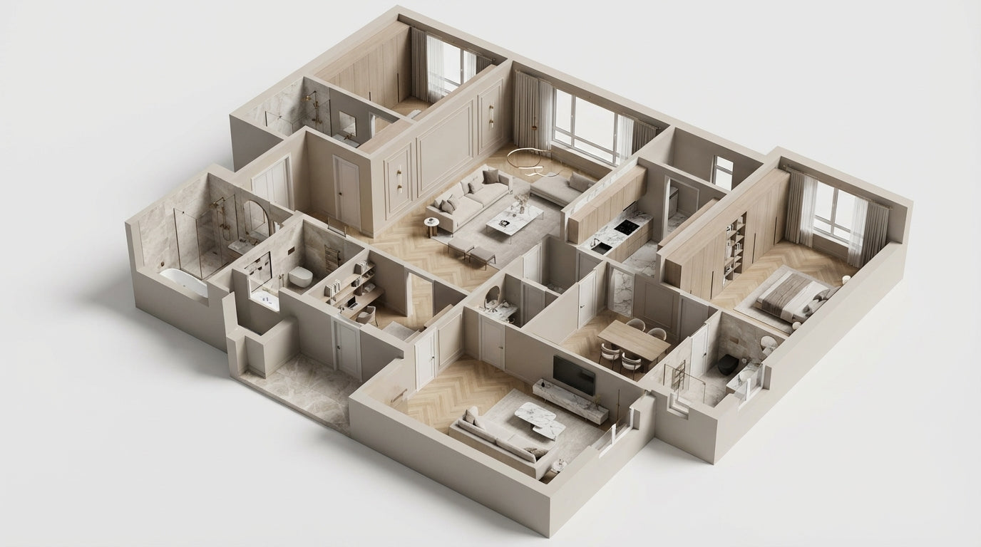
Interior Design & Renovation
Capture indoor spaces quickly and generate accurate floor plans and 3D models for design and visualization.
- Fast room scanning
- Accurate measurements
- Ready for 3D modeling and rendering
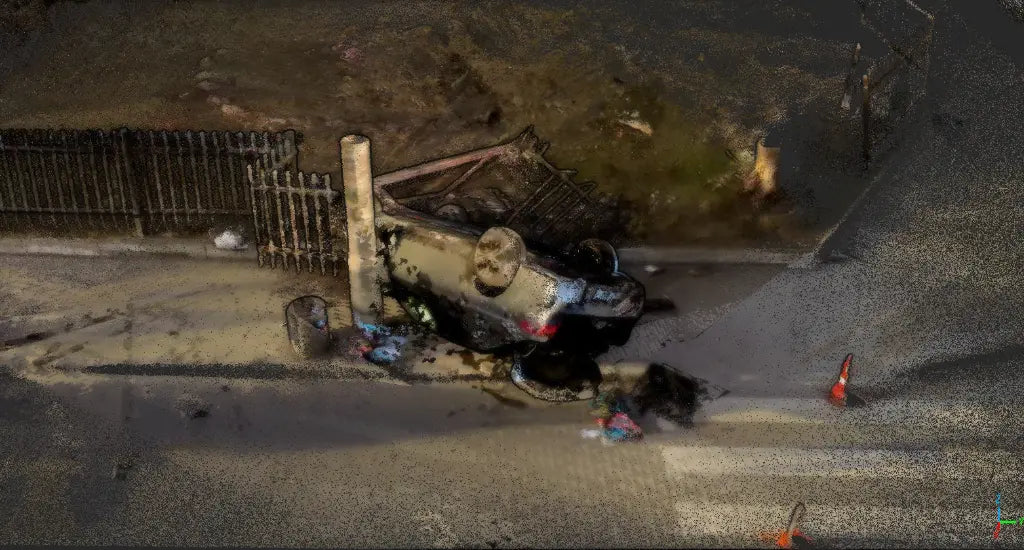
Traffic Accident Investigation
Capture, document, and analyze accident scenes quickly with FJD Trion's LiDAR technology. Improve accuracy, reduce on-site time, and streamline case handling with detailed 3D models and digital evidence.
- Fast documentation of accident scenes
- Accurate data collection with 3D models
- Streamlined evidence sharing for faster investigations
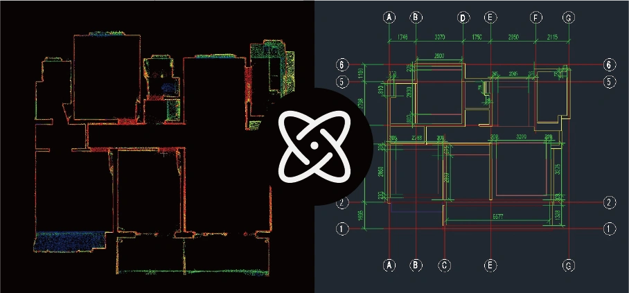
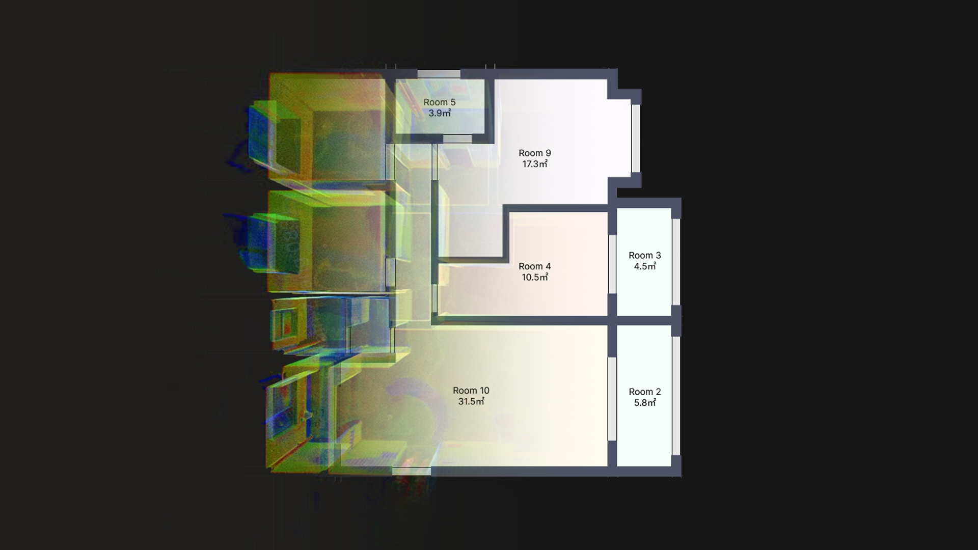
Scan-to-CAD
Quickly convert real‑world environments into accurate CAD drawings using FJD Trion LiDAR scanning and point cloud processing.
- Fast reality capture with portable LiDAR scanning
- High‑accuracy 3D data ready for CAD workflows
- Direct DWG/DXF export without third‑party software
High-precision LiDAR & GNSS solutions for surveying, mapping, and positioning tasks.
POSITION & MEASURE
• Land surveying & topographic mapping
• Construction staking & site positioning
• Boundary measurement & control points
• High-accuracy GNSS workflows
Capture real-world environments with portable and professional 3D LiDAR scanning solutions.
SCAN & MODEL
• 3D mapping & reality capture
• Building, terrain, and asset modeling
• Point cloud generation & visualization
• Scan-to-BIM and digital twins
End-to-end software tools for processing, visualizing, and managing spatial data.
SOFTWARE & WORKFLOWS
• GNSS & LiDAR data processing
• Point cloud editing, analysis & plans
• Scan-to-CAD / Scan-to-BIM workflows
• Cloud & desktop collaboration

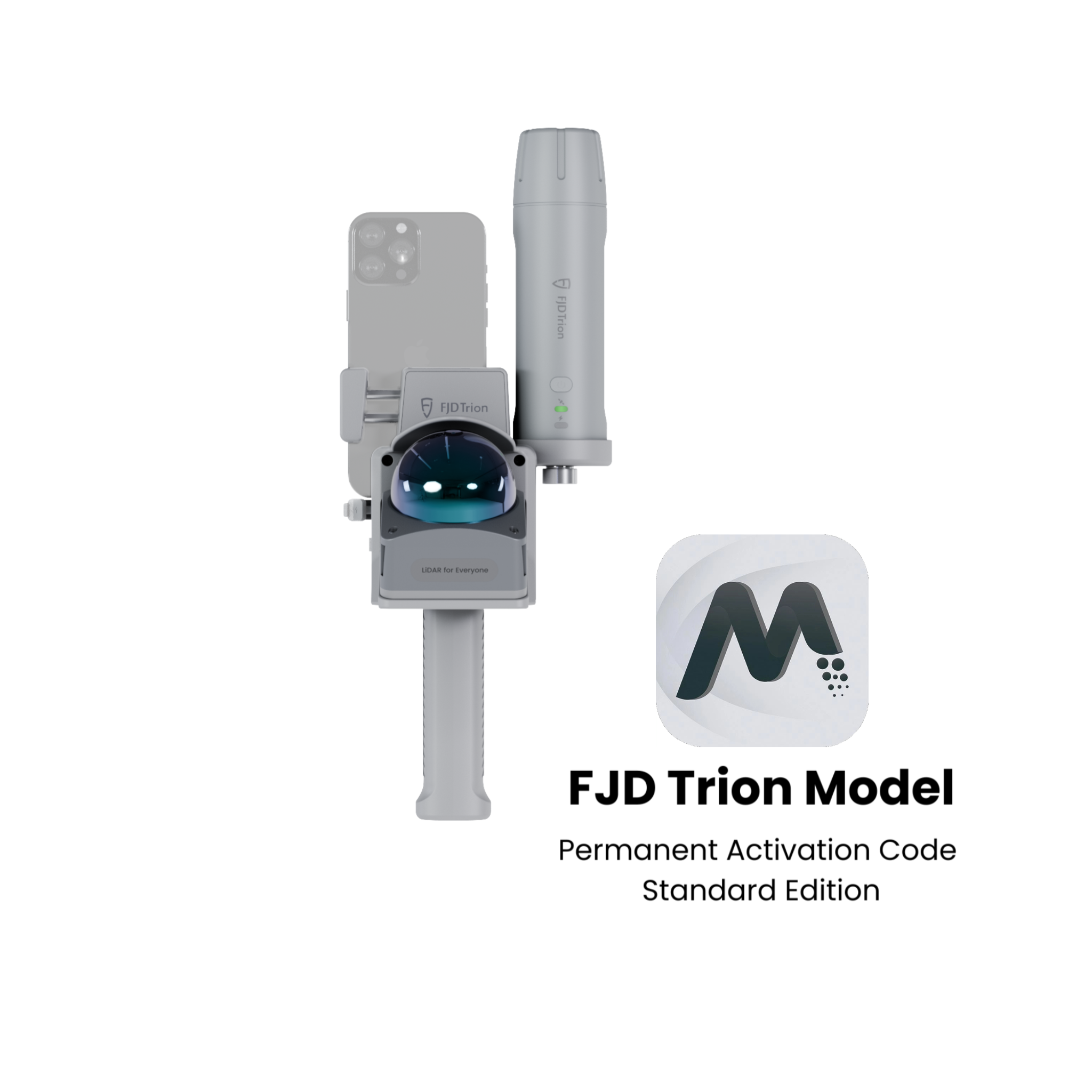
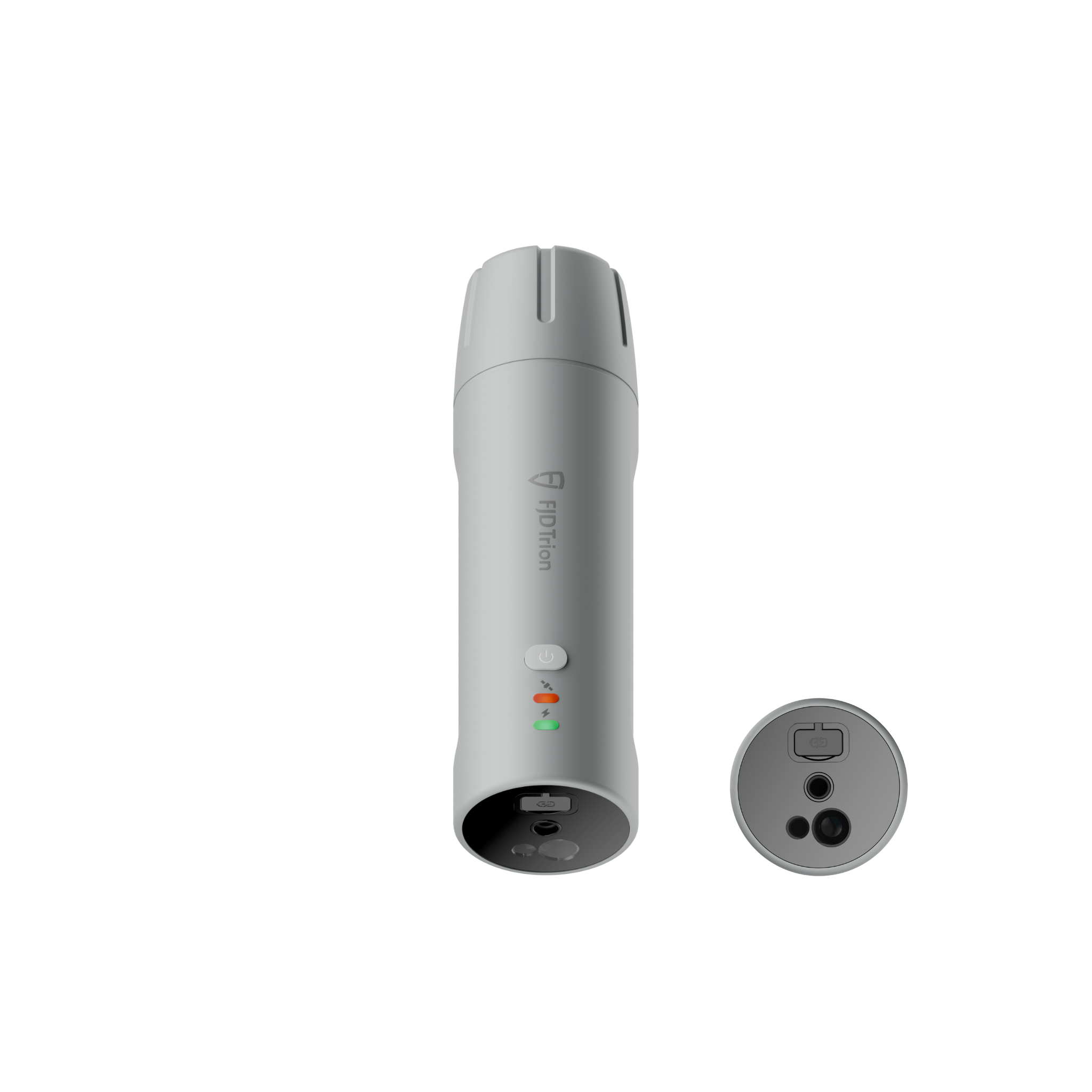
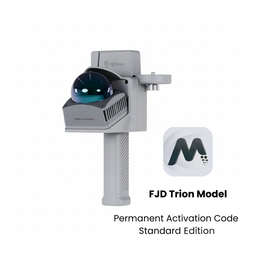
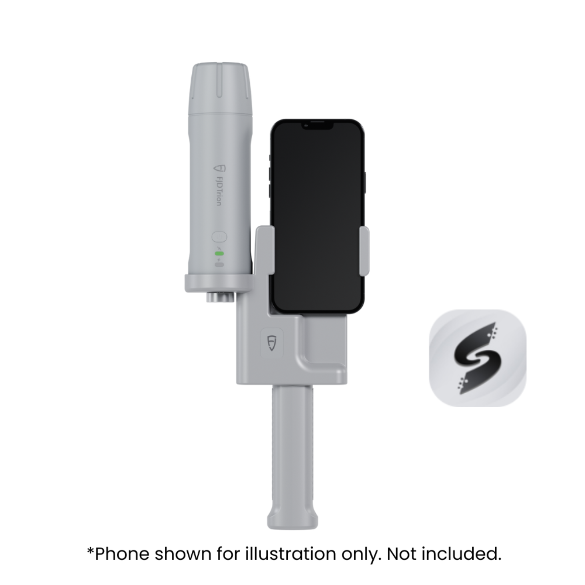
Why FJD Trion


Who’s Using FJD Trion