


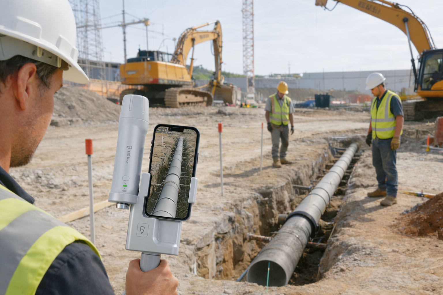
Integrated Pipeline Surveying Solution: V4e Scan
With rapid field capture and precise measurements, V4e Scan makes as-built documentation simple and reliable. Surveyors can accurately capture trench geometry, pipeline placement, and surrounding assets, ensuring that construction records truly reflect on-site conditions. This minimizes discrepancies between design and reality, supporting compliance, inspection, and long-term asset management.
Select your kit