

LiDAR surveying has become one of the most powerful technologies used in modern mapping, construction, architecture, and infrastructure inspection. By using laser scanning technology to capture millions of spatial measurements in seconds, LiDAR scanners allow professionals to create highly detailed 3D models of real-world environments. However, one of the most common questions people ask is simple: how accurate is LiDAR surveying?
The answer depends on several factors, including the type of LiDAR scanner used, the surveying environment, and how the collected data is processed. With the rapid development of handheld LiDAR scanners and mobile mapping systems, LiDAR surveying is becoming more accessible not only to professional surveyors but also to engineers, architects, and individual users who want accurate spatial measurements.
This article explains the typical accuracy of LiDAR surveying, the factors that influence measurement precision, and how modern LiDAR scanners can achieve reliable results for many real-world applications.
What is LiDAR Surveying?
LiDAR surveying is a method of collecting spatial data using laser scanning technology. The word LiDAR stands for Light Detection and Ranging. A LiDAR scanner emits laser pulses toward surrounding objects and measures the time it takes for those pulses to return. By calculating these distances, the system determines the precise position of surfaces and objects in the environment.
When millions of these measurements are captured every second, they form a dense point cloud. This point cloud represents a detailed three-dimensional model of the scanned environment.
LiDAR surveying is widely used in industries such as:
- land surveying
- construction measurement
- building documentation
- infrastructure inspection
- forestry mapping
- urban planning
Modern LiDAR scanning systems often combine several technologies, including handheld LiDAR scanners, mobile mapping systems, and point cloud processing software. These tools work together to capture and process spatial data efficiently.
Typical Accuracy of LiDAR Surveying
The accuracy of LiDAR surveying depends largely on the equipment used and the conditions of the survey. In many practical applications, modern LiDAR scanners can achieve accuracy levels between 2 and 5 centimeters.
Different LiDAR systems provide different levels of accuracy.
Airborne LiDAR systems used for large-scale terrain mapping typically provide accuracy between 5 and 15 centimeters.
Vehicle-mounted mobile mapping systems often achieve accuracy between 2 and 5 centimeters when mapping roads or infrastructure.
Handheld LiDAR scanners used for building measurement and indoor mapping can achieve similar accuracy, especially when combined with advanced algorithms and proper scanning workflows.
For most surveying applications such as building measurement, floor plan creation, and construction documentation, centimeter-level accuracy is considered highly reliable.
Factors That Affect LiDAR Surveying Accuracy
Although LiDAR technology is extremely powerful, several factors influence the final accuracy of a LiDAR survey.
Quality of the LiDAR Scanner
The performance of the LiDAR scanner itself plays a major role in determining accuracy. High-quality LiDAR scanners capture more laser measurements per second and produce denser point clouds.
A higher point density allows for more precise surface reconstruction and measurement.
Professional LiDAR scanners designed for surveying applications typically include advanced sensors and optimized algorithms that improve mapping stability.
Scanning Environment
Environmental conditions can also affect LiDAR surveying results. Surfaces that strongly reflect or absorb laser light may influence measurement results.
For example, mirrors, glass, or water surfaces may cause reflections that affect the point cloud. Dense vegetation can also reduce measurement clarity.
Indoor environments often provide excellent scanning conditions because walls, furniture, and structural features create stable reference points for the scanning system.
Survey Workflow
The way a LiDAR survey is performed also affects the accuracy of the final result. Maintaining a stable scanning motion and ensuring that enough environmental features are captured helps improve mapping stability.
For handheld LiDAR scanning, it is generally recommended to move at a steady speed and avoid sudden movements. Consistent scanning paths help ensure that the point cloud remains aligned.
Data Processing
LiDAR data often requires processing after the scan is completed. Point cloud processing software is used to refine the raw data and improve measurement accuracy.
Typical processing steps include:
- point cloud alignment
- noise filtering
- coordinate correction
- control point optimization
These processes help ensure that the final 3D model accurately represents the scanned environment.
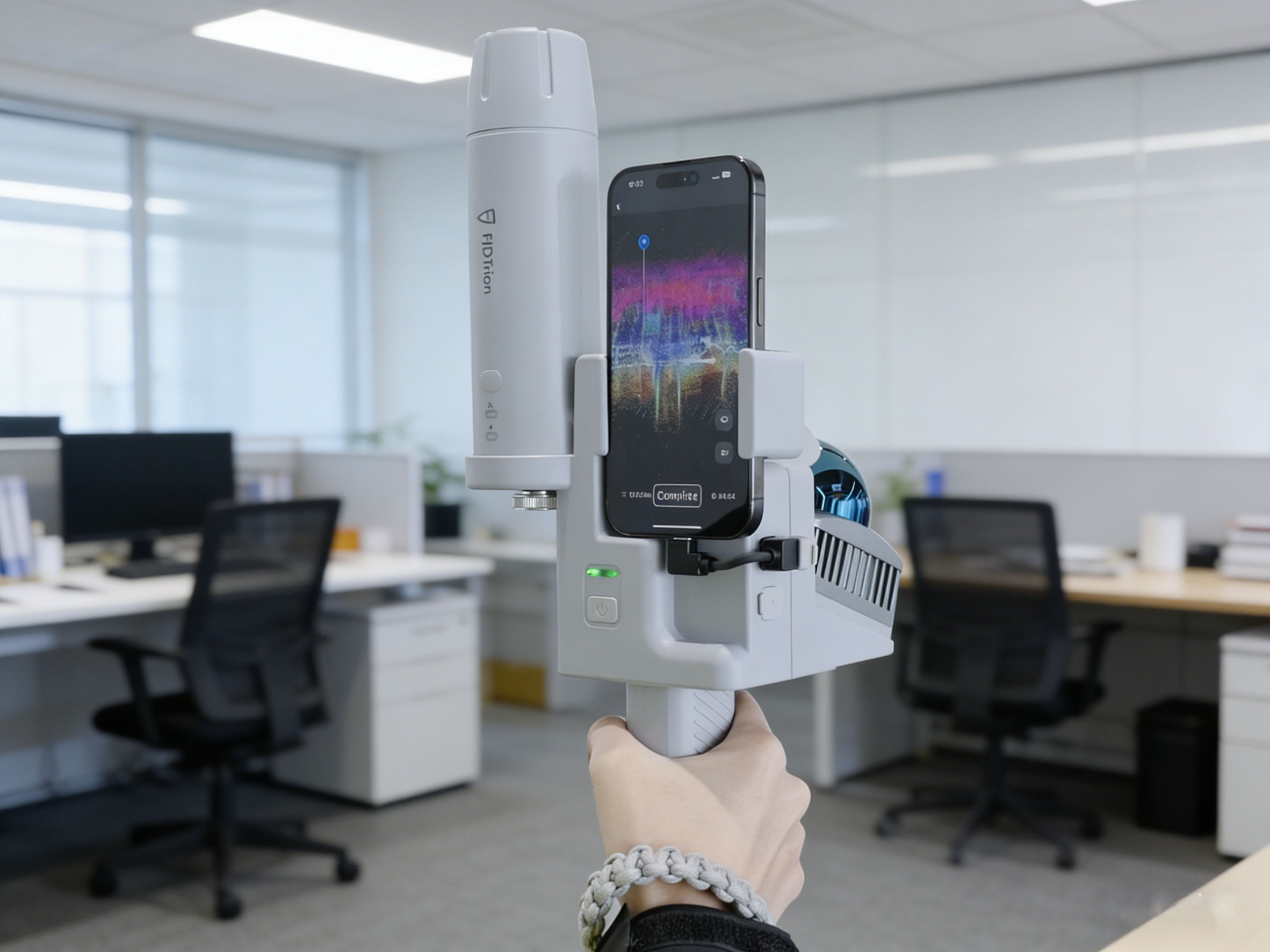
Accuracy of Handheld LiDAR Scanners
Handheld LiDAR scanners have become increasingly popular in recent years because they allow users to scan environments quickly and easily. Instead of setting up a tripod-based laser scanner, users can walk through an area while the handheld LiDAR scanner continuously captures spatial data.
Modern handheld LiDAR scanners used for surveying can capture millions of points per second while maintaining centimeter-level accuracy.
These scanners are commonly used for:
- building measurement
- construction site documentation
- facility management
- renovation planning
- digital twin modeling
Because of their portability and efficiency, many professionals and individuals are now searching for handheld LiDAR scanners for sale when upgrading their surveying tools.
Mobile Mapping and LiDAR Surveying
Mobile mapping systems combine LiDAR scanning with motion tracking technologies to capture spatial data while moving through an environment.
This approach significantly improves surveying efficiency, especially when mapping large areas such as buildings, warehouses, or infrastructure corridors.
Mobile mapping systems allow users to complete surveys much faster than traditional surveying methods. Instead of measuring points individually, the system captures continuous spatial data while the operator moves through the environment.
The combination of LiDAR scanning and mobile mapping technology allows surveyors to create accurate digital models in a fraction of the time required by traditional methods.
Applications of Accurate LiDAR Surveying
LiDAR surveying is used across many industries where accurate spatial data is essential.
In construction, LiDAR scanning helps verify building dimensions and monitor construction progress.
In architecture, LiDAR scanners capture detailed measurements that support renovation and restoration projects.
In infrastructure inspection, LiDAR surveying allows engineers to analyze structures such as bridges, tunnels, and railways.
Urban planners use LiDAR mapping to build detailed 3D models of cities for development and transportation planning.
Because of its speed and accuracy, LiDAR surveying is becoming a standard tool for professionals who need reliable spatial data.
Choosing the Right LiDAR Scanner
When selecting a LiDAR scanner for surveying applications, users should consider several factors including scanning range, point density, portability, and compatibility with processing software.
Handheld LiDAR scanners and mobile mapping systems provide an excellent balance of portability and accuracy. They allow users to capture detailed spatial data quickly while maintaining reliable measurement precision.
Many users looking to improve their surveying workflow explore LiDAR scanners for sale through professional LiDAR scanner stores that specialize in advanced mapping technology.
Choosing the right LiDAR scanner can greatly improve both the speed and accuracy of surveying projects.
The Future of LiDAR Surveying
LiDAR surveying continues to evolve as scanning technology becomes more advanced and accessible. Improvements in sensor technology, computing power, and point cloud processing software are making LiDAR scanning faster and more accurate.
Handheld LiDAR scanners and mobile mapping systems are helping reduce the barriers to entry for spatial data collection. Engineers, architects, and construction professionals can now perform accurate LiDAR surveys without relying on complex traditional equipment.
As demand for accurate digital models grows, LiDAR surveying will continue to play an important role in modern mapping and measurement workflows.
Conclusion
LiDAR surveying typically achieves accuracy between 2 and 5 centimeters when using modern LiDAR scanners and proper workflows. Handheld LiDAR scanners and mobile mapping systems make it easier to capture accurate spatial data for applications such as construction measurement, building documentation, and infrastructure inspection.
What Does the LiDAR Scanner Do?
SLAM Surveying vs Traditional Survey Methods: Pros, Cons, and Accuracy